Source: Sciene-Metrix, Scimago Lab, Inc.; Beauchesne, O. H., data: Scopus–Elsevier
Norbert Csizmadia
25/11/2025 23:09
Megatrends draw our future according to laws, rules and patterns. These long-term global changes affect nature, societies, the economy and culture alike. Among these megatrends, three “super-megatrends” will stand out in the coming period: geopolitics, sustainability (through global climate change) and technological transformation. To understand the relationships among them, we need keys: the three most important passwords are connectivity, complexity and sustainability, which together reshape the global map and economy.
Geopolitics is not a transient shock but the reality itself, shaping markets, supply-chains and investment strategies. Geopolitical changes are lasting forces, and leaders must integrate geopolitics into basic planning — thereby preparing for long-term adaptation too. To understand the drivers of geopolitics, a geographic perspective is indispensable. This complex geographic approach is a method in which data, with the help of maps, becomes a visual language through which we can understand how things connect. Geopolitical connectivity builds on long-term peaceful cooperation.
Competitive connectivity now defines the most important geopolitical advantage and has become the most important geopolitical factor. Hungary recognised the new Eurasian era of transformation already in 2011, and through its strategy of connectivity and Eastern opening, it opened not only towards the West but also towards Eastern markets.
The geography of connectivity
The geography of being interconnected is referred to as connectography (a term coined by Parag Khanna in his book Connectography – Mapping the Future of Global Civilization, published in 2016). In Hungary, the concept first appeared in 2016 in Geomoment, and again in 2020 in Geofusion. In fact, the expression geofusion, built on connectivity, underscores how the Hungarian government is correctly basing its long-term grand strategy on connectivity. As our world-renowned physicist and network researcher, Albert-László Barabási, noted in his endorsement of Geofusion
“Today networks draw the significance of our spaces, and through these we can understand change. Geofusion shows us how to think about the role of distance and space, which is just as important.”
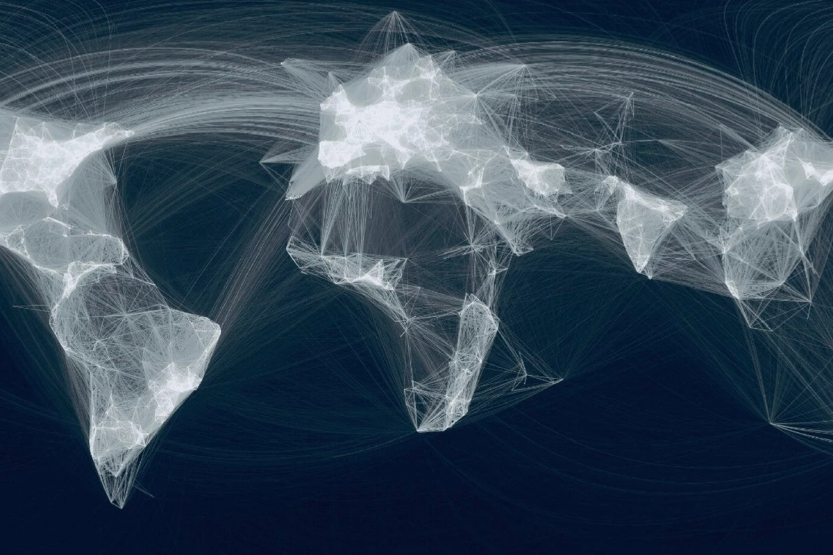
Our world is becoming ever more complex, and we must recognise the value of connectivity, regionalism and other forces that shape the world far more than our traditional geopolitical theories based only on territory, size and military power. Connectivity has become a new world paradigm — the old maps drawn by classic political boundaries can be extended by lines that connect places: power lines, motorways, rail-networks, internet cables, flight-paths — symbols of global networks.
Networks and fusions — geographic patterns
Modern life is unimaginable without networks. While natural networks evolve organically and almost invisibly, human-made networks need to be designed and made operational by us. The better we understand networks, the more efficiently we can build effective structures. Networks consist of nodes that connect to each other. This draws attention to the importance of network hubs and their connections. Connecting network hubs is connectivity. The geography of networks, the connectedness of places, is geofusion. In our new geofusion maps, connectivity factors, infrastructure and knowledge networks converge in geographic hubs — in other words, HUBs.
In the era of fusions and networks the key question is how a given geographical place connects to the rest of the world. And if that place has vision and a future-orientation, focuses on knowledge, talent, technology and uses its geographic endowments, then it can become a new regional or global centre.
The long-term winners of connectivity will be the gate-regions — not only maritime gateways but also overland gateways like Central Asia or indeed Central Europe, which holds geostrategic importance not only east-west but also north-south. It is no coincidence that connectivity matters especially for territorially small nations, which need to become great in terms of knowledge.
In the geography of connectivity world-maps are no longer interpreted by distances but by lines of connection and networks that create new economic gravitational centres. In this world only those win who connect. Smart countries, like Singapore or the United Arab Emirates, link in every direction and never take sides. In a world that is becoming ever more connected, that is how you win. In geopolitics we always worry about wars, not resources — but why fight when you can trade? Every region in the world matters, because each region is part of the network. Every continent counts, but the emphasis is no longer on borders, it is on links. Connectivity in the future will mean cooperation between nodes, built in peace, not by bloc formation.
The author is a geographer